The Okanagan Valley, with its breathtaking landscapes and vibrant ecosystems, is a region of immense natural beauty nestled in the heart of British Columbia, Canada. However, as development pressures increase, the delicate balance between economic progress and environmental conservation becomes ever more crucial.
In this dynamic landscape, the role of land surveying emerges as a pivotal factor in ensuring sustainable growth while preserving the region’s natural heritage.
Understanding the Landscape
The Okanagan Valley spans a diverse range of ecosystems, from lush vineyards and orchards to pristine lakes and rugged mountain terrain. This diversity presents unique challenges for land development and conservation efforts alike. Effective land surveying in the Okanagan Valley requires a deep understanding of these ecosystems and their interconnectivity.
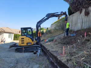
Land surveyors play a critical role in mapping and assessing land parcels, identifying environmentally sensitive areas, and recommending strategies for sustainable development. By leveraging cutting-edge technology and expertise, land surveyors can help stakeholders navigate complex regulatory frameworks while minimizing environmental impact.
Challenges and Opportunities
One of the primary challenges facing the Okanagan Valley is the pressure of urbanization and infrastructure development. As population growth and tourism demand increase, so does the need for housing, transportation networks, and recreational facilities. However, unchecked development can lead to habitat fragmentation, loss of biodiversity, and degradation of water quality.
Balancing these competing interests requires a holistic approach that integrates environmental considerations into land use planning and decision-making processes. Land surveyors can contribute to this effort by conducting thorough environmental assessments, identifying conservation priorities, and designing sustainable land management strategies.
Sustainability in Action
Several initiatives in the Okanagan Valley exemplify the principles of sustainability in land surveying and development. For instance, the protection of riparian zones along waterways helps maintain water quality and wildlife habitat while enhancing the scenic beauty of the landscape. Similarly, the adoption of green infrastructure practices, such as permeable paving and stormwater retention ponds, minimizes the ecological footprint of urban development projects.
Moreover, the promotion of smart growth principles, such as compact urban design and mixed land use zoning, encourages sustainable transportation options and reduces reliance on private vehicles. By incorporating these principles into land surveying practices, stakeholders can create vibrant, resilient communities that thrive in harmony with nature.
The Role of Technology
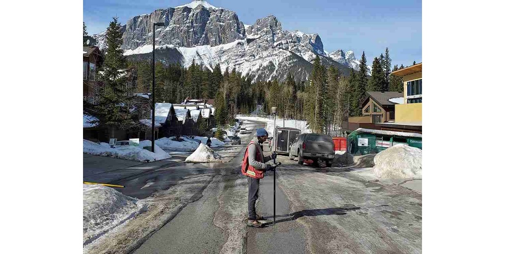
Innovations in geospatial technology have revolutionized the field of land surveying, enabling more accurate and efficient data collection and analysis. Advanced tools such as LiDAR (Light Detection and Ranging) and aerial imagery provide detailed insights into the topography, vegetation cover, and land use patterns of the Okanagan Valley.
By harnessing the power of Geographic Information Systems (GIS), land surveyors can overlay environmental data with land development plans, identify potential conflicts, and propose alternative solutions that minimize ecological disturbance. This integrated approach allows for informed decision-making and proactive management of natural resources.
Core Geomatics: Leading the Way in Sustainable Land Surveying
In the pursuit of sustainability in the Okanagan Valley, Core Geomatics emerges as a trusted partner and industry leader. With a proven track record of delivering high-quality land surveying services, Core Geomatics combines technical expertise with a commitment to environmental stewardship.
Utilizing state-of-the-art equipment and methodologies, Core Geomatics offers comprehensive solutions tailored to the unique needs of clients in the Okanagan Valley. Whether conducting land boundary surveys, environmental impact assessments, or land development planning, Core Geomatics employs best practices to ensure sustainable outcomes.
Conclusion
Sustainability and land surveying are inextricably linked in the Okanagan Valley, where the preservation of natural resources is paramount to long-term prosperity. By embracing innovative technologies, fostering collaboration among stakeholders, and prioritizing environmental conservation, the region can achieve a harmonious balance between development and ecological integrity. With Core Geomatics as a partner, the journey towards a sustainable future in the Okanagan Valley is within reach.