While enquiring about getting the right geomatics services in Calgary, there would be numerous technical terms like LiDAR, RGB, laser surveying, UAV surveys and a lot more jargon that are thrown at the customers.
With so many technologies coming into the foray in geomatics services, there lies confusion about what’s right, what’s to be used and where exactly. But, this is where an experienced Geomatics Services company like Core Geomatics comes into the picture.
One emerging technology shaping up in the geomatics and surveying sector is drone surveying. While the industry is still at the adoption stage of the technology, there have been several positive reviews about the technology.
Here’s all there is to know about drone surveys and the use of drones in Geomatics in Calgary.
What is a Drone Survey?
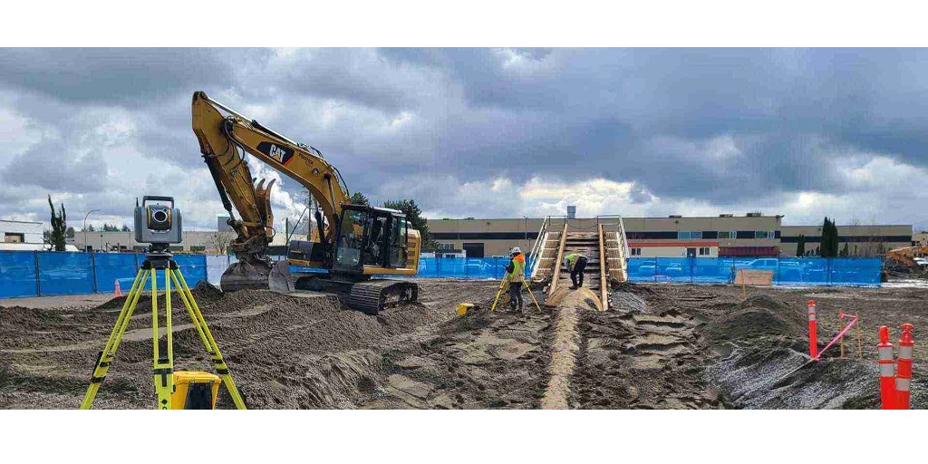
A drone survey, as the name suggests, refers to using a drone or an UAV to collect data using surveys. Surveying with a drone offers amazing opportunities to businesses providing geomatics services in Calgary.
Drones collect data by using RGB or LiDAR technology. An RGB camera in a drone takes shots from different angles and then marks them with coordinates.
What are the benefits of drone surveying?
There’s a reason why the entire industry has been very bullish about the use of drones and UAVs in geomatics services. Here are some of the benefits of using drones for geomatics and surveying purposes.
1. Reduced time and costs
It is a clear fact that capturing data with the help of drones is way faster than any existing traditional methods. Moreover, it also requires lesser manpower. They can identify and collect the data points in a much faster manner, ensuring that the overall project is executed on time.
2. Provide accurate information
Compared to a total station, that focuses on measuring only individual data points, a single drone flight can collect and produce thousands of measurements, represented in different formats, making the collection, analysis and presentation of data much easier.
3. Map areas that are otherwise inaccessible
This is one of the best use cases of a drone deployed in providing geomatics services. A drone can take off and fly from anywhere. It does not require a large chunk of land, or any other infrastructure to fly.
With the onset of drones in the geomatics services space, no area is unsafe, or unsuitable, plus it does not require involvement of any other agencies such as traffic police to close down highways or cordon off a patch of land.
Conclusion: Are Drones Effective for Geomatic Services?
The answer is yes. Geomatics services are relatively newer than other professions, and hence usually sees constant upgrades and newer technologies.
The entry of drones in geomatics and land surveying services has changed the game for the professionals in the industry. It provides accurate data, in a lesser amount of time and at a smaller cost.
When looking for geomatics services in Calgary, the first thing the customers should keep in mind is whether the business they are onboarding does use drones and other such technologies or not.
If they do, it is actually a good sign, showing that the company is constantly evolving and upgrading their services to provide the best quality work to their customers.
One such geomatic services company in Calgary is Core Geomatics. They assist their customers in planning and monitoring ther entire project with the help of UAVs and drones. Their drones and UAV services can work for aerial photography, video analysis, elevation and surface monitoring and lots more.
Check out Core Geomatics today to understand more about their latest technologies.